 Photo 1 Photo 1 Fred Feller writes:
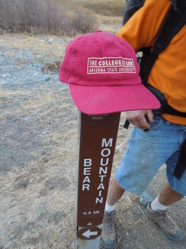
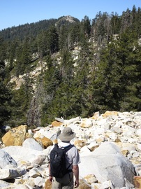
"This past weekend, brother Jon and I managed to summit Bear Mountain #18 in Henry W. Coe State Park, Santa Clara County,California. We set off from my house in Berkeley at 9:30am on Saturday, considerably later than our planned 7:30am start time. After fortifying ourselves at McDonald’s, we arrived at Coe Headquarters about noon and hit the trail at precisely 12:34. The weather was cool but cloudless, the trails generally wide and dusty and almost always very steep. Total elevation gain and loss for the weekend was about 8000 feet. As webmaster David Sklansky has said 'you go to the high Sierra to train for Henry Coe.'"About 4pm Saturday, we found ourselves on Bear Mountain Road, travelling, for once, on relatively level ground. [photo 1] The topo map said the road would get very steep, so we decided to make camp wherever it did so. When we reached the spot it was obvious and dramatic. The road ahead went sharply upward, in a series of switchbacks.
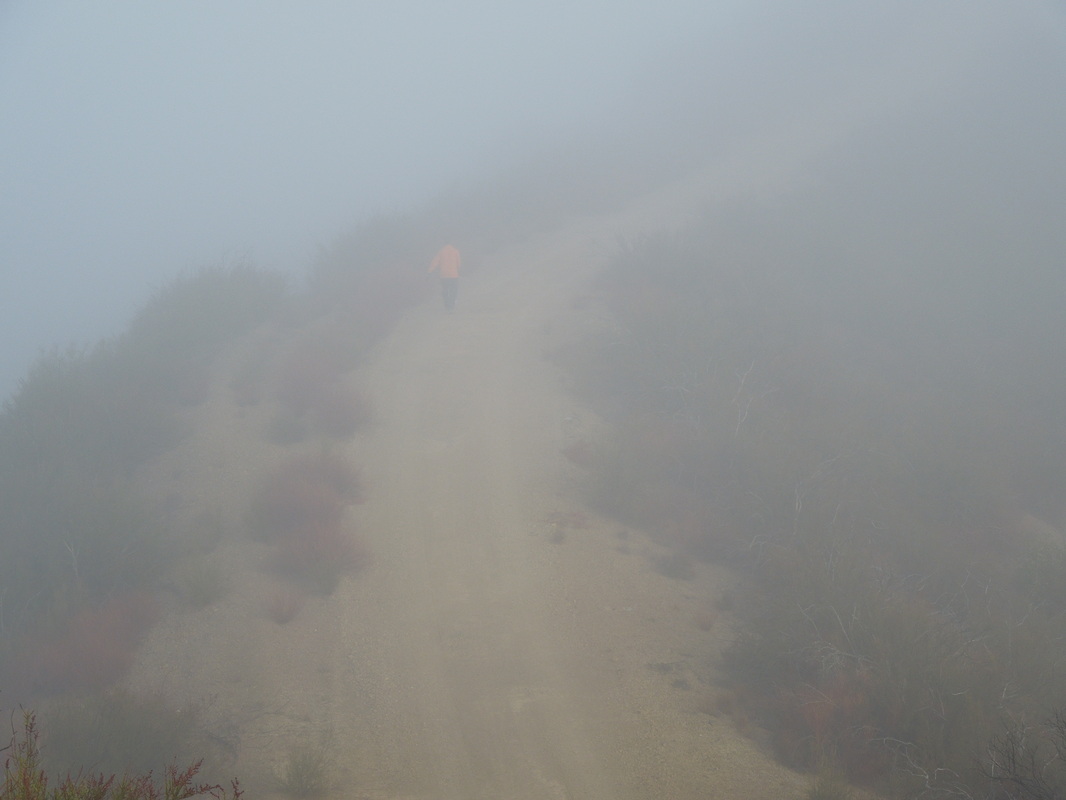
Photo 2
|
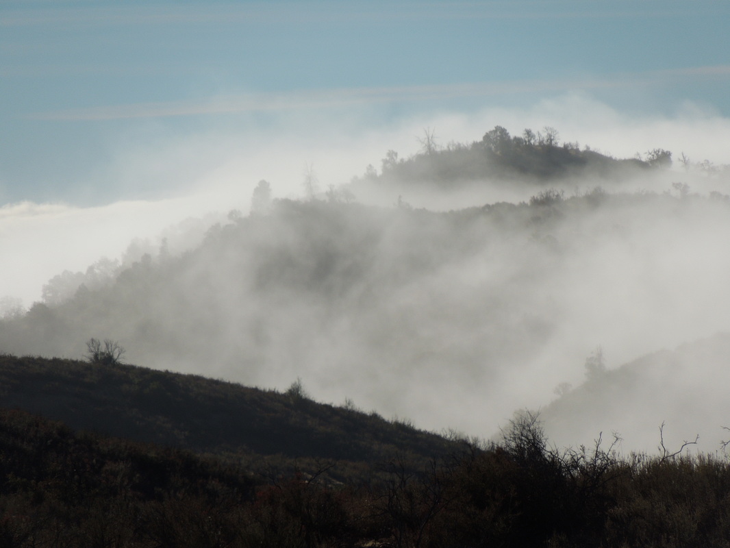
Photo 3
| "Jon had already devised a series of strategies for the rest of the ascent. Plan A was that we would rest for awhile, then climb to the summit and back down for dinner. We then realized that there would be a full moon that night, so Plan B was to take a longer rest, eat dinner and then climb to the summit by moonlight. After Jon cooked us a fine dinner of bean soup with salami, he devised Plan C, which was to sleep until 5am and then head up to see the sunrise at the summit. This would give us 11 hours of sleep, which we assumed would be adequate. 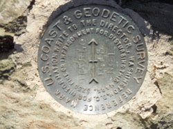 Photo 4 Photo 4 "The moonlight was so bright that night that it was actually hard to sleep. Clouds and fog moved in about 4am and we got out of our sleeping bags at 7, after a good 13 hours of sack time, if not sleep time. This necessitated Plan D, which was to go right up the Mountain and then back down for breakfast. As we started upward, it was cold and foggy and the scenery was quite magical. [photo 2] Tall peaks rising out of the mist and clouds forming into rainbow shapes as the fog slowly lifted.[photo 3] It was just under 3 miles to the summit, which took us 2 hours, without our packs.
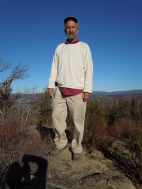 Photo 5 Photo 5
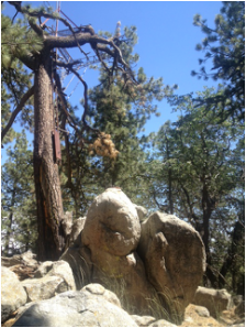
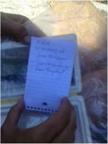
"We almost missed the summit, because it was not marked on the road. However, when we backtracked to what appeared to be the road’s highest point, we saw a small foot trail off the road going just a couple of feet higher. There we found the appropriate Coast and Geodesic Survey and Army Corps of Engineers markers and we knew we had the right spot.[photo4] After taking time out for thought, remembrance, photos, and commemorative shots of Old Jake, we headed down the mountain.[photos 5 and 6] By this time the fog was nearly gone and Jon was out of his jacket and shirt, cruising along topless in the sun.[photos 7 and 8]
Photo 6
|
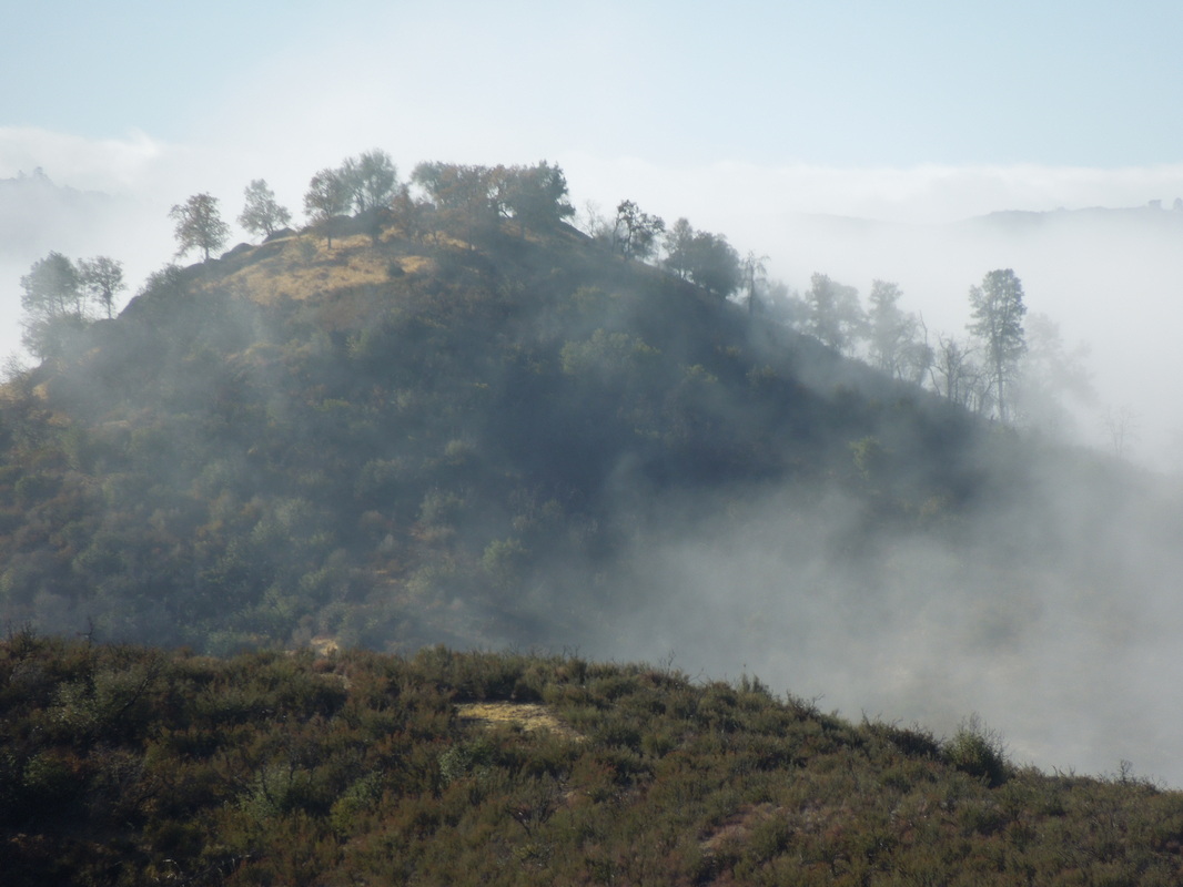
Photo 7
| "Back at base camp, Jon cooked up a delicious breakfast of bacon and eggs, courtesy of Joe’s camping egg carton. [photo 9] I was carrying Joe’s pack and using his sleeping bag on my first overnight backpacking trip in more than 30 years.
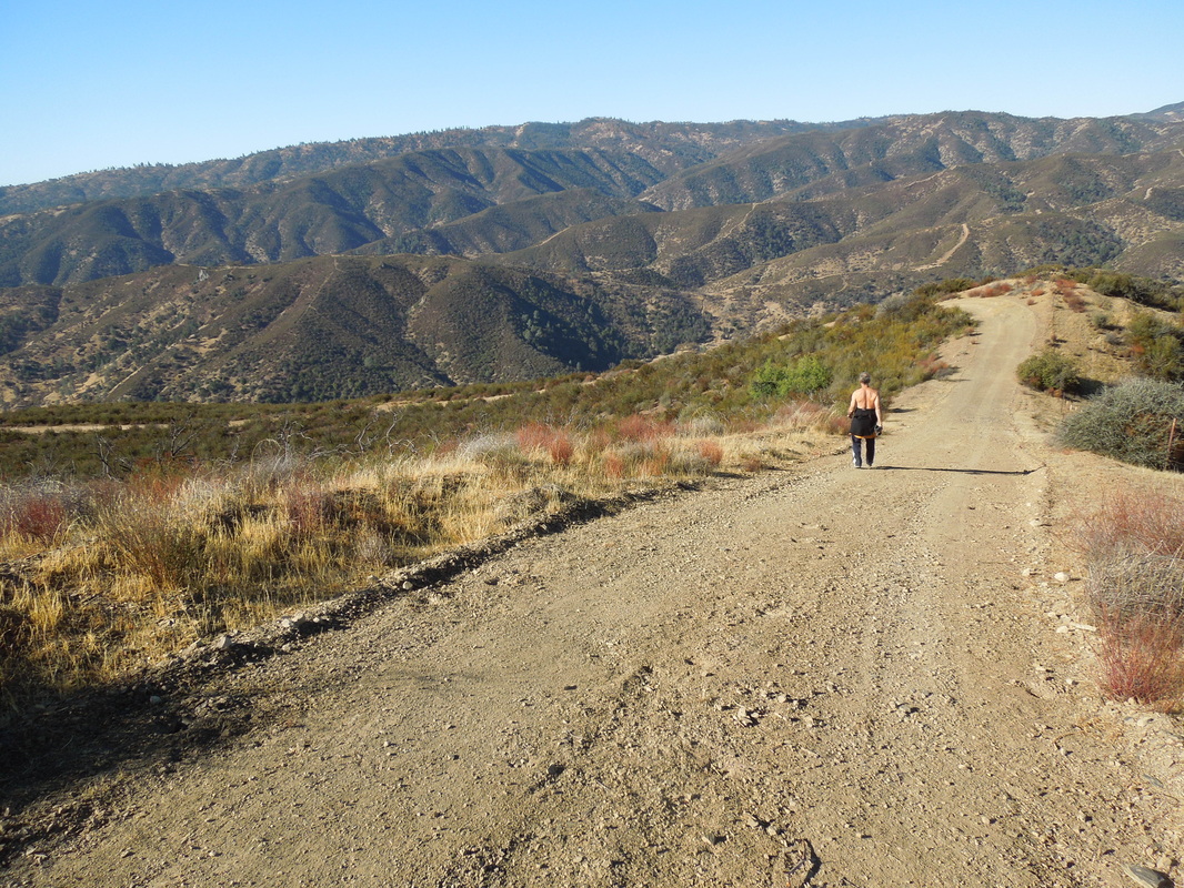
Photo 8
|
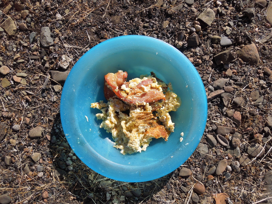
Photo 9
| 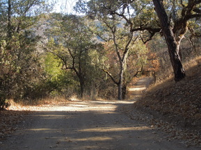 Photo 10 Photo 10 "It took us all day to make the trip back to headquarters. We took a slightly longer route with more elevation change on the way back because I preferred the dirt roads to the somewhat more precarious creek side trails.[photo 10] All in all, we hiked about 23 miles over the two days. Jon did about a mile extra, because he took a side trip on the way back to retrieve a rock he had admired but left behind the day before. "For anyone who has bothered to read this far and would like one, I will be making 2014 calendars from my photos of the trip, with some help from Shutterfly. I will gladly send one, for free, to anyone who lets me know who they are and where to have it mailed."Congratulations, Fred and Jon!
Bill Joost writes:
"Inspired by and in honor of Joe Feller, this correspondent is pleased to report the summiting of Bear Mountain, CO on Friday, October 11, 2013 by yours truly, Paul Bendheim and William Guilford, with the able assistance and support of Joe Moore at our Basecamp Headquarters (Doc Bendheim's Trooper). The summit was reached the day after the season's first snowfall, making conditions slippery but doable for the above trio. Located off Highway 84, between the thriving S. Colorado metropolis of Chromo (at least it still has a post office) and its better-known neighbor (Pagosa Springs), Bear Mountain rises to 8,420' and provides those with the requisite grit to climb it a panoramic view of S. Colorado ad N. New Mexico. Documentary evidence (pictures) to follow in due course."
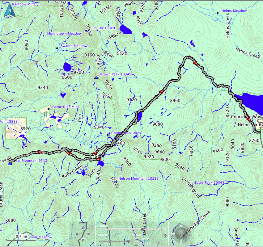
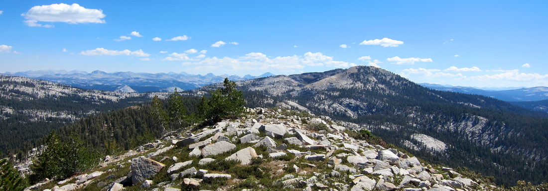 View east from Bear Mountain #13 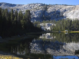 Nelson Lakes Nelson Lakes Bear Mountain #13, in Fresno County, is the highest Bear Mountain in California, topping out at around 9500 feet. I climbed it last Sunday with my friend John Wiley. It's a hefty hike: 18 miles round trip, much of it cross country. John was game even though he never knew Joe. (He took a course in labor law from Joe's father, David Feller, though.) We camped Saturday night at Courtright Reservoir, a couple of hours east of Madera, and were on the trail by 6:00 Sunday morning. From the Cliff Lake trailhead to Nelson Lakes was about five miles. Nice trail, but the cross country traveling after Nelson Lakes was even nicer. We climbed the ridge west of Nelson Lakes, and then followed the ridge as it curved southwest past Sportsman Lake and then back north again. That brought us about a mile and a half from Bear Mountain.
 Approaching Bear Mountain #13 Approaching Bear Mountain #13 Hiking west, we crossed a jeep road, traveled along another ridge, climbed steeply for a quarter-mile or so, and finally reached the summit. (If you have a high-clearance 4WD, you could shorten this hike considerably, but you'd miss some of the nicest parts.) Fabulous views from the top, especially to the east. There was a weird register box that instead of a register had little knickknacks and toiletries and a couple of business cards left by other hikers. We left a note about our climb and mentioned Joe and the Bear Mountain Project.
We had originally thought we’d try to climb Nelson Mountain and Eagle Peak, too, but by the time we got to the top of Bear Mountain it was approaching noon, and we needed to get back to the Bay Area that evening. So we left the other peaks for another day.
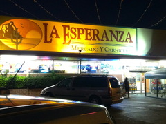 On the return trip, John figured out we could save some effort by taking the jeep road north a little bit and then contouring around at 9200 rather than along the top of the ridge, which was a hundred or so feet higher. So we did that. We got back to the trailhead around 4:30 and stopped for dinner at La Esperanza in Madera, which I think Joe would have enjoyed.
David Sklansky
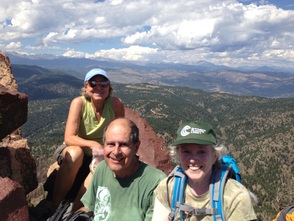 Yesterday Alan Davis, Tessa Davis, and Susan Steele climbed Bear Peak, just west of Boulder, Colorado, in honor of Joe Feller. Alan writes: It was an 11-mile round-trip hike on a 90 degree day, and we underestimated the amount of water we’d need, so it was more challenging than we anticipated. But satisfying.
Fred Feller passes along a message from Bill Guilford:
"I started out trying to write a brief account of my failed mission to Bear Mountain. It was late at night and my mind, maybe a bit lubricated, wandered a bit and I never actually got around to the details of my failed trip. . . . Anyway, here's what I did write:
"Dear Joe,
"Sorry to say, I failed you, but I will keep on trying to bag us a bear, bear mountain, that is.
"I only knew you for maybe three days or so, back when we ran that relay from Calistoga to Monterrey a few years back, must have been around 2006 or so.
"Anyway, you made such a strong impression on me that, when I heard of your passing over to the other side and recalled the wonderful experience of that race --which included your spouting off effusively on a wide range of subjects, as well as your bantering quite entertainingly with the other Fellers in the van (including one – Michael (guess he was there to stand in for Dan) -- who didn’t even come into the world via Gilda and David (yeah, I know that embedded parentheses are bad form)), the first words that came to mind were from Zhuangzi.
"There’s a story in the so-called Miscellaneous Chapters of Zhuangzi about a bad-ass fellow name Robber Zhi. Zhi and his men have been rambling and rampaging about the countryside in what is now Shandong province in China, generally disrupting the social order, such as it was in those days – 300 BC or so. As the story goes, Confucius, who was trying to foist his principles on how a society ought to be run onto the populace in general and in particular onto any royalty that might tolerate his prissiness, was quite annoyed by Zhi’s behavior. He happened to know Zhi’s brother and asked him to make an introduction for him to Zhi. Zhi’s brother shuddered and told Confucius that his meeting with Zhi would be a very bad idea, because, as he said, Zhi has a mind like a gushing fountain (心如涌泉) and his will is like a cyclone (意如飄風). He said a few other things too to try to dissuade Confucius from his mission, but those words really stuck with me and through me they kinda stuck to you. It’s not that I really want to suggest that you were like Zhi in all ways. After all, when Confucius went to meet him, Zhi and his men were resting on the slope of Taishan (the most sacred mountain in China) snacking on human livers, which one has to assume they had not acquired in a very friendly or sociable way. Rather it was the image of the gushing fountain and the cyclone that reminded me of you. I would not be surprised if those who know you well would agree that those words capture something vital about you.
"その忍者は誰です"
Laura Newman writes:
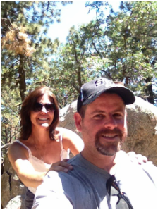
"'If we go for a hike near Tehachapi, we can have lunch at a really good BBQ joint'; that is how I convinced my fella to drive me two hours from Los Angeles to hike up Bear Mountain. Had I just explained the Bear Mountain project, climbing for Joe, it would have been a no-brainer. I had called early in the week and was granted a pass by the Bear Valley Springs HOA to check out the area and for me that included a short hike to a peak on behalf of Joe.
"First stop was lunch at Red House BBQ in Tehachapi. It did not disappoint and worth a detour on future trips up the 14 and 395 highways. Then on to visit the Cesar Chavez National Monument in Keene, California, just a short drive down Highway 58. After a short tour of the museum and grounds we headed over to Bear Valley Springs HOA and picked up a huge packet of maps, information, and properties for sale should we be interested. We quickly headed up to Paramount Drive and parked at the end of the road, walking back to the intersection of Paramount and Wilderness Drive, where we found an old road heading up. Following this road we encountered a couple of gates but the road was open and outside of any no-trespassing areas. It was a short hike to the top, finding a lookout, benchmark and the much sought for summit register. Joe’s name was signed in and a few pictures taken then time to head home. One last stop at the Bear Valley Country Club for a drink at the bar to cool off completed the day.
"I didn’t get a chance to meet Joe on the trails but I have a feeling that I know him and more importantly that I would have liked him. In true peakbagger fashion, he chose a word that set a goal. Most of us who hike have similar dreams of completing lists; using it only as an excuse to get outside and appreciate the mountains in all their variety offered. I am sure that Joe would have enjoyed this outing in its entirety from BBQ to peak."
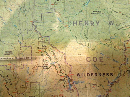 Photo #1 Photo #1 Fred Feller writes:
"On Saturday, June 29, the hottest day of the year so far in the San Francisco Bay Area, brother Jon and I left the relative cool of Mill Valley and Berkeley for an attempt at Bear Mountain #18 in the wilds of Santa Clara County, east of Silicon Valley. (See photo #1). Bear Mountain 18 is located in Henry W. Coe State Park which, considering its proximity to the mega-million population centers of the Bay Area, is amazingly isolated. Relying on Google Map directions, we chose the northern approach by way of Livermore, where the temperature hit 105 degrees.
"We were using the same route as was attempted by Bill Guilford in a valiant but failed effort on June 17, while brother Guilford was en route to Southern California, after attending the memorial for Joe in Berkeley on June 15. Guilford had used this route based on my directions and warned me that it appeared to be faulty, but I dismissed this as a result of carelessness on his part, plus the fact that he had only my phoned-in instructions to go by, with no map, no GPS device and a cell phone with no reception. We were equipped with a detailed map, GPS and compass in addition to the Google route map, which appeared to take us straight to the summit of Bear Mountain.
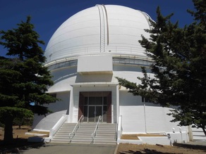 Photo #2 Photo #2 "Nevertheless, Guilford was right. After a couple of wrong turns and a return to Livermore for more gas, we followed the only road possible until it ended on the slopes of Mount Hamilton, at the famed Lick Observatory (photo #2). In the Observatory gift shop, there were many maps of the universe and the solar system available but none of the surrounding territory. However, when I told the saleslady that we were trying to find Henry W. Coe State Park, she cheerfully said: 'Oh you can’t get there from here.' She told me that the roads on my Google map were private, belonging to ranchers who were serious about their No Trespassing signs and quite likely to take shots at anyone failing to heed their warning.
"Even if we had been tempted to ignore this advice, we confirmed, on our way back to Livermore, that every dirt road leading in the direction we wanted to go was blocked by a locked gate. In fact, these gates usually had multiple locks on them; we counted eight on one in particular. Why the need for so many locks I don’t know, but it made the gates look a little like those bridges on the Seine in Paris on which the railings are covered with locks supposedly put there by lovers who have then thrown the keys into the river.
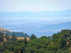 Photo #3 Photo #3 "On more closely examining my Henry Coe Park map, I noticed that 'No Park Access”'was typed in very small letters next to the illusory road we had been attempting to find. Brother Jon thought it was rather late in the day (literally) to be making this discovery, but he agreed that, despite our failure to reach Bear Mountain, or even the park in which it is located, it had been a day well spent. The golden, rolling hills dotted with live oaks we had driven through were a fine sight and we thoroughly enjoyed the visit to the Lick Observatory, which neither of us had ever been to before, nor are we very likely to visit it again, considering its distance from home or from any other attraction.
"Jon had had enough for one weekend, but I was determined to make another attempt, this time from the west. Sunday morning I headed out in Joe’s Jeep on my own, driving south down Interstate 880 and then California 101, past San Jose to Morgan Hill and then east. A very pleasant 13 mile drive into the hills took me to Coe Ranch Headquarters, where I spoke to several very helpful park rangers. When I asked whether I could get to Hobbs Road (which on my map leads to Blue Ridge Road and then to Bear Mountain Road) from where we were, they said 'sure, are you on foot or on bicycle?' When I replied that I was in a Jeep, they laughed and told me that vehicles were not allowed in the Park, except for one day a year, in April, by lottery.
"I knew that I was not going to hike the 12 miles from HQ to Bear Mountain that day, in the 100 degree heat, but I asked whether the 24 mile round-trip could be accomplished in one day, if the hiker was in good shape and started early enough. I was told that it could be done, but that the route was brutal, with an up and down elevation change totaling more than that from Yosemite Valley to the top of Half Dome. I was advised that a 3-day backpacking trip would be the best way to go, preferably in spring.
"So that’s the plan, although brother Jon may go for the one day trek before I get around to the backpacking trip. Meanwhile, this Bear Mountain can be seen in photo #3, somewhere out there. Joe’s Jeep is in photo #4 looking wistfully toward the mountains. Although I never even made it on to the map in photo #1, I enjoyed both day trips and recommend them to anyone with the time and the inclination to visit either the Lick Observatory or the historical Coe Ranch Headquarters (photo #5), at which I spent a pleasant few minutes."
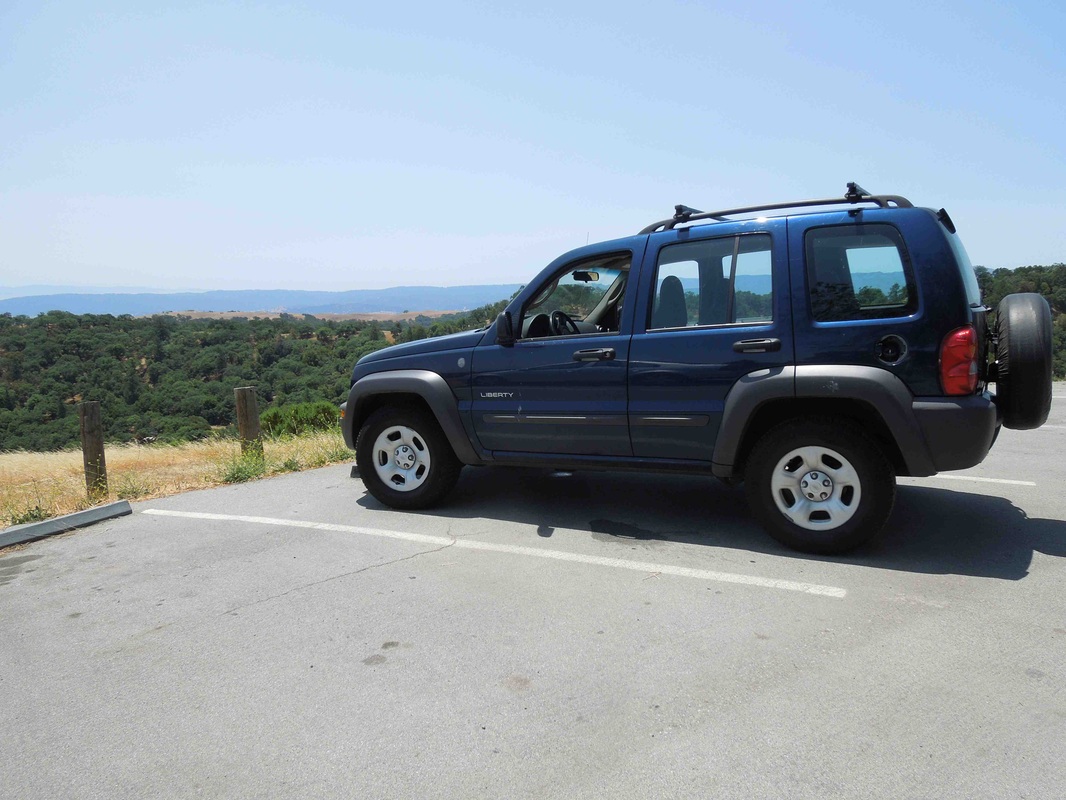 Photo #4 | 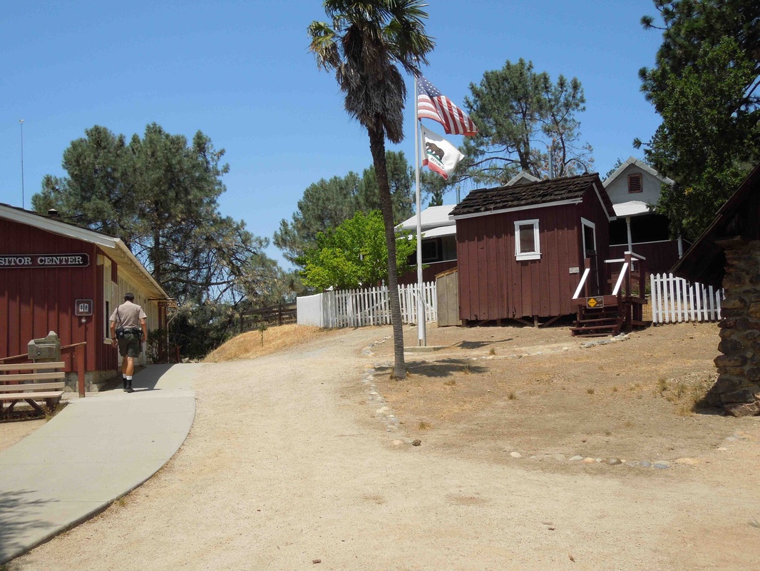 Photo #5 |
Laura Newman writes:
"We are going for a leisurely Saturday drive from Los Angeles to Bear Valley Springs this weekend. I have been granted access to Bear Mountain [#14] via the Homeowners Association.... The peak also happens to be a CaP2K.
I have room in our car for 2 more people if anyone is interested in joining Ken and I. We will probably leave in the morning, pick up our pass and do the hike following Dennis Poulin's tracks (which happens to be the same MO for getting the access). It is 2.5 miles RT and 600 ft gain. The high temperature for the day is 82d. Lunch likely afterwards in nearby Tehachapi or thereabouts. It is about a 2 hour drive each way and we need to be back in Los Angeles by 4ish for a poker tournament.
If you are interested in either going with us or meeting nearby and hopping in our car, please reply directly to me.... Happy 4th everyone."
Andy Martin writes: "I've climbed 4 Bear Mountains 'by accident' to date [#21 on 8/1/2003, #14 on 5/11/2004, #3 on 5/21/2007, and #11 on 9/6/2010]. Don't have pics, but could provide route info if needed."
Fred Johnson writes:
"I have climbed 4 of California's Bear Mountains:
#11 5-22-05 Solo. Located about 1/4 mile beyond locked gate on upper Stallion Rd off CA 4. Site of CalFire's 'Fowler Bear Mountain' L.O.
#19 8-10-07 Drive-up with CalFire worker to CalFire's 'Shasta Bear Mountain' L.O. Approached over private property by gated road near #14884 Dry Creek Rd
#20 10-10-06 Solo from locked gate less than 1 mile from summit, which is site of CalFire's "Siskiyou Bear Mountain" L.O. Approached from Harris Springs Rd near Hambone via a network of FS and logging roads.
#21 8-7-95 Solo from Doe Flat and Devils Punchbowl via trail and XC.
Cheers and good luck with this new project in memory of Joe Feller---obviously one of those good guys whose productive life ends much too soon."
|
 RSS Feed