 Photo 1
 Fred Feller writes:
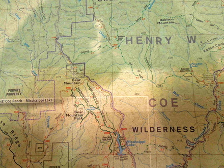
"This past weekend, brother Jon and I managed to summit Bear Mountain #18 in Henry W. Coe State Park, Santa Clara County,California. We set off from my house in Berkeley at 9:30am on Saturday, considerably later than our planned 7:30am start time. After fortifying ourselves at McDonald’s, we arrived at Coe Headquarters about noon and hit the trail at precisely 12:34. The weather was cool but cloudless, the trails generally wide and dusty and almost always very steep. Total elevation gain and loss for the weekend was about 8000 feet. As webmaster David Sklansky has said 'you go to the high Sierra to train for Henry Coe.'
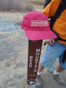
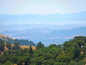
"About 4pm Saturday, we found ourselves on Bear Mountain Road, travelling, for once, on relatively level ground. [photo 1] The topo map said the road would get very steep, so we decided to make camp wherever it did so. When we reached the spot it was obvious and dramatic. The road ahead went sharply upward, in a series of switchbacks.
"This past weekend, brother Jon and I managed to summit Bear Mountain #18 in Henry W. Coe State Park, Santa Clara County,California. We set off from my house in Berkeley at 9:30am on Saturday, considerably later than our planned 7:30am start time. After fortifying ourselves at McDonald’s, we arrived at Coe Headquarters about noon and hit the trail at precisely 12:34. The weather was cool but cloudless, the trails generally wide and dusty and almost always very steep. Total elevation gain and loss for the weekend was about 8000 feet. As webmaster David Sklansky has said 'you go to the high Sierra to train for Henry Coe.'
"About 4pm Saturday, we found ourselves on Bear Mountain Road, travelling, for once, on relatively level ground. [photo 1] The topo map said the road would get very steep, so we decided to make camp wherever it did so. When we reached the spot it was obvious and dramatic. The road ahead went sharply upward, in a series of switchbacks.
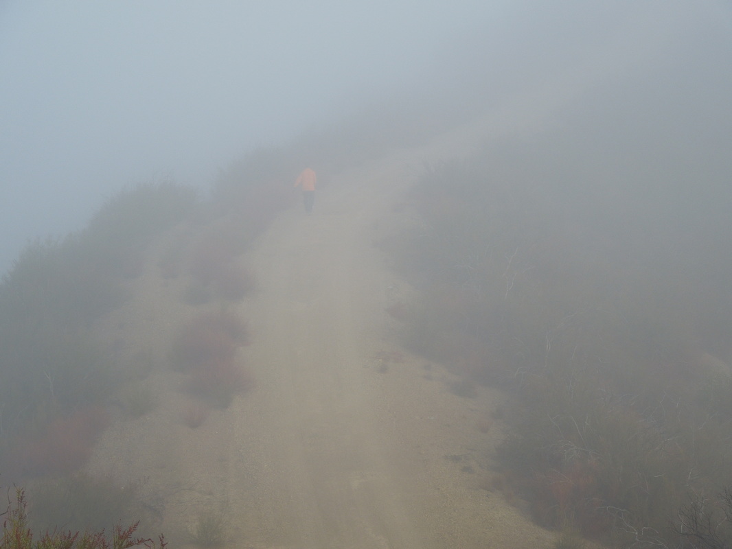
Photo 2
| 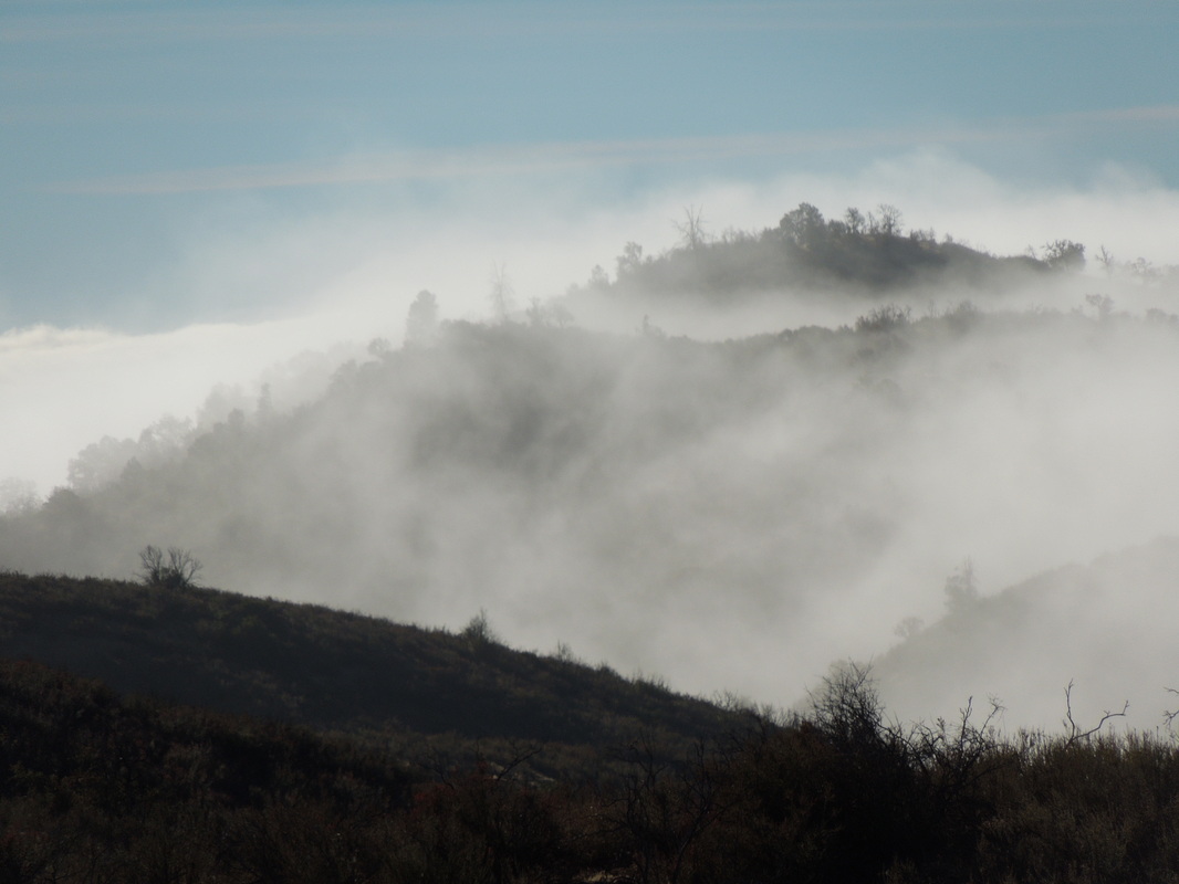
Photo 3
|
"Jon had already devised a series of strategies for the rest of the ascent. Plan A was that we would rest for awhile, then climb to the summit and back down for dinner. We then realized that there would be a full moon that night, so Plan B was to take a longer rest, eat dinner and then climb to the summit by moonlight. After Jon cooked us a fine dinner of bean soup with salami, he devised Plan C, which was to sleep until 5am and then head up to see the sunrise at the summit. This would give us 11 hours of sleep, which we assumed would be adequate.
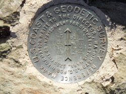 Photo 4
 "The moonlight was so bright that night that it was actually hard to sleep. Clouds and fog moved in about 4am and we got out of our sleeping bags at 7, after a good 13 hours of sack time, if not sleep time. This necessitated Plan D, which was to go right up the Mountain and then back down for breakfast. As we started upward, it was cold and foggy and the scenery was quite magical. [photo 2] Tall peaks rising out of the mist and clouds forming into rainbow shapes as the fog slowly lifted.[photo 3] It was just under 3 miles to the summit, which took us 2 hours, without our packs.
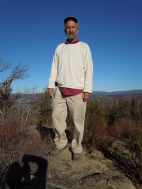 Photo 5
 "We almost missed the summit, because it was not marked on the road. However, when we backtracked to what appeared to be the road’s highest point, we saw a small foot trail off the road going just a couple of feet higher. There we found the appropriate Coast and Geodesic Survey and Army Corps of Engineers markers and we knew we had the right spot.[photo4] After taking time out for thought, remembrance, photos, and commemorative shots of Old Jake, we headed down the mountain.[photos 5 and 6] By this time the fog was nearly gone and Jon was out of his jacket and shirt, cruising along topless in the sun.[photos 7 and 8]
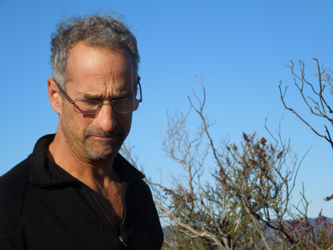
Photo 6
| 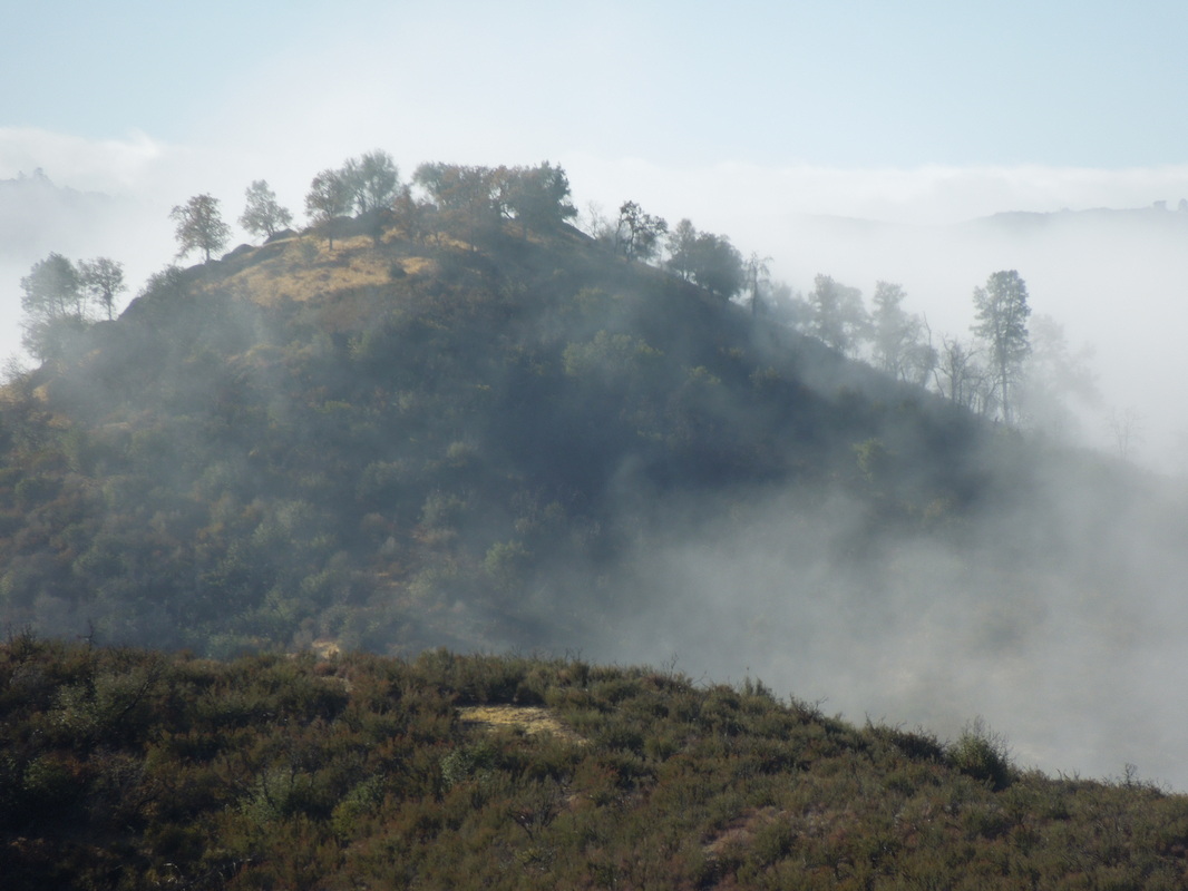
Photo 7
|
"Back at base camp, Jon cooked up a delicious breakfast of bacon and eggs, courtesy of Joe’s camping egg carton. [photo 9] I was carrying Joe’s pack and using his sleeping bag on my first overnight backpacking trip in more than 30 years.
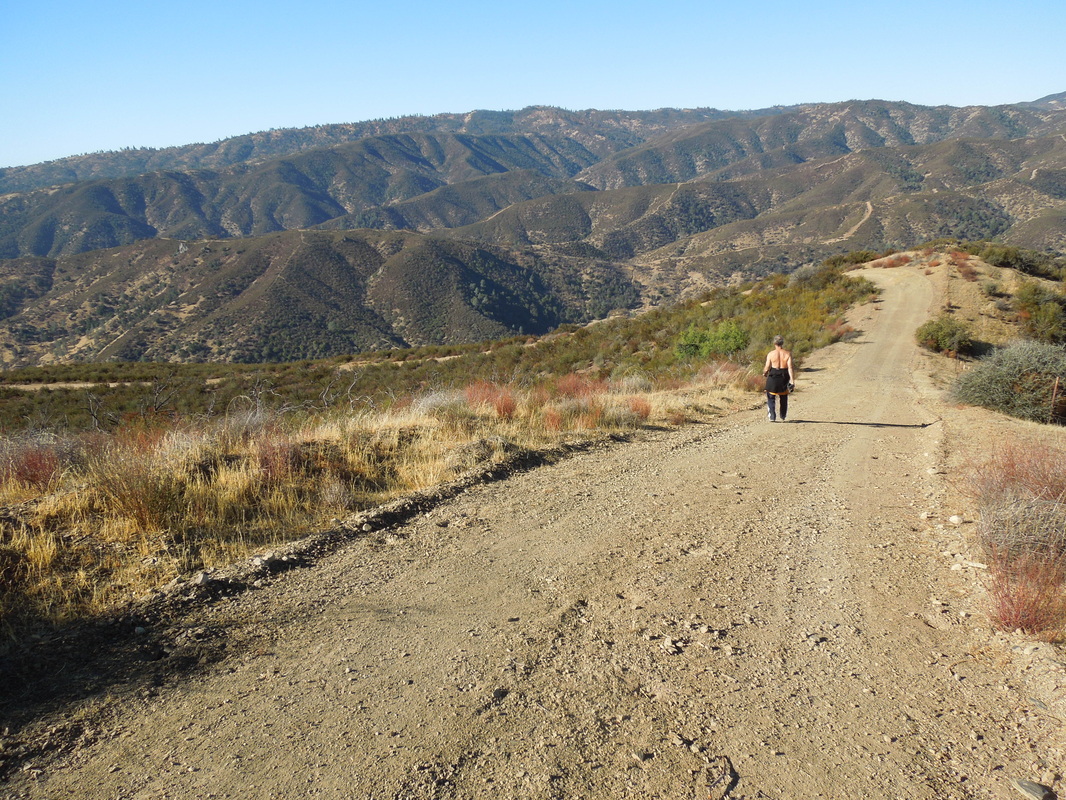
Photo 8
| 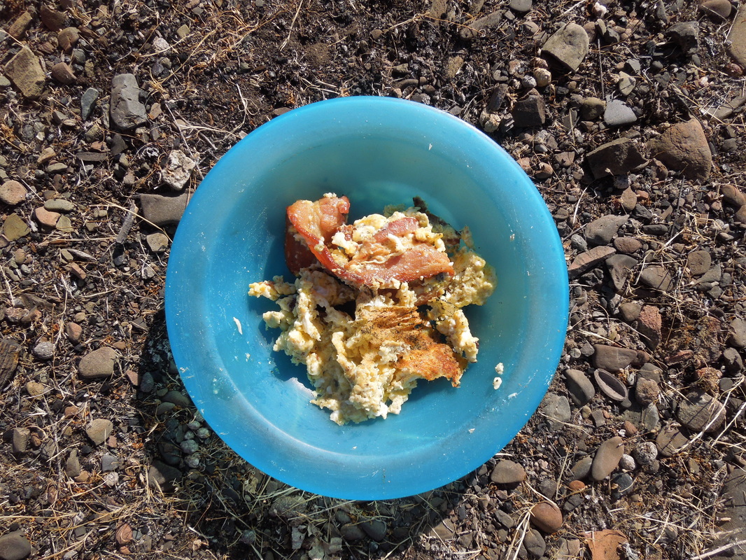
Photo 9
|
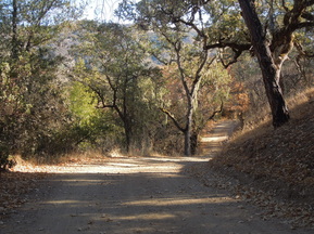 Photo 10
 "It took us all day to make the trip back to headquarters. We took a slightly longer route with more elevation change on the way back because I preferred the dirt roads to the somewhat more precarious creek side trails.[photo 10] All in all, we hiked about 23 miles over the two days. Jon did about a mile extra, because he took a side trip on the way back to retrieve a rock he had admired but left behind the day before.
"For anyone who has bothered to read this far and would like one, I will be making 2014 calendars from my photos of the trip, with some help from Shutterfly. I will gladly send one, for free, to anyone who lets me know who they are and where to have it mailed."
Congratulations, Fred and Jon!
"For anyone who has bothered to read this far and would like one, I will be making 2014 calendars from my photos of the trip, with some help from Shutterfly. I will gladly send one, for free, to anyone who lets me know who they are and where to have it mailed."
Congratulations, Fred and Jon!
 RSS Feed